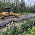
Forest operations are a sequence of events as a response to planned or unplanned changes that can alter a decision process or operation deployment. The success of current and future forest management, particularly when dealing with triggered changes stemming from extreme climate change–induced events, will require prompt, timely, and reliable information obtained at local scales. In the chapter, “Remote Sensing at Local Scales for Operational Forestry,” Vepakomma, Cormier, and two other co-authors discuss the role of remote sensing platforms and sensors in providing rapid and detailed information feeds that aid as a decision support in forest operations with the goal of mitigating and adapting to climate change.
Vepakomma also co-authored another chapter, “Remote Sensing Tools for Monitoring Forests and Tracking Their Dynamics.” This chapter discusses how novel remote sensing technologies, expanding computing capabilities, and emerging geospatial methods play an increasingly important role in forest resource management.
The book is available free of charge in English through open access on the Springer website, with a French version planned soon.
For more information on FPInnovations’ work with remote sensing tools, contact Udayalakshmi Vepakomma.


